Drone Mapping & Aerial Site Data
1 Hour
14
0
$1,234.00
Description
Condition
Payment Types Accepted
 Venmo
VenmoNOW BOOKING: Drone Mapping & Aerial Site Data — Wasatch Front
Big survey firms charge big-office prices and put you on a three-week waitlist. I fly your site this week and get your data back in 24–48 hours — usually for less than half of what they'd charge.
WHAT YOU GET:
• High-resolution aerial site maps you can measure right on your screen
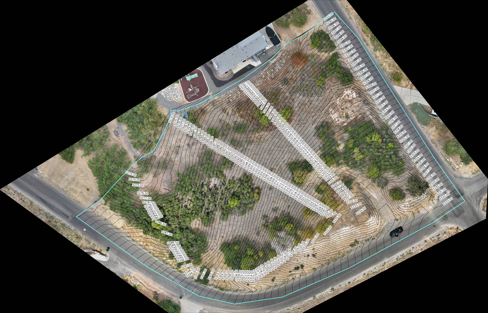
• Elevation and contour data for grading, drainage, and site planning
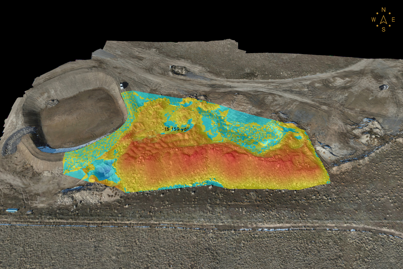
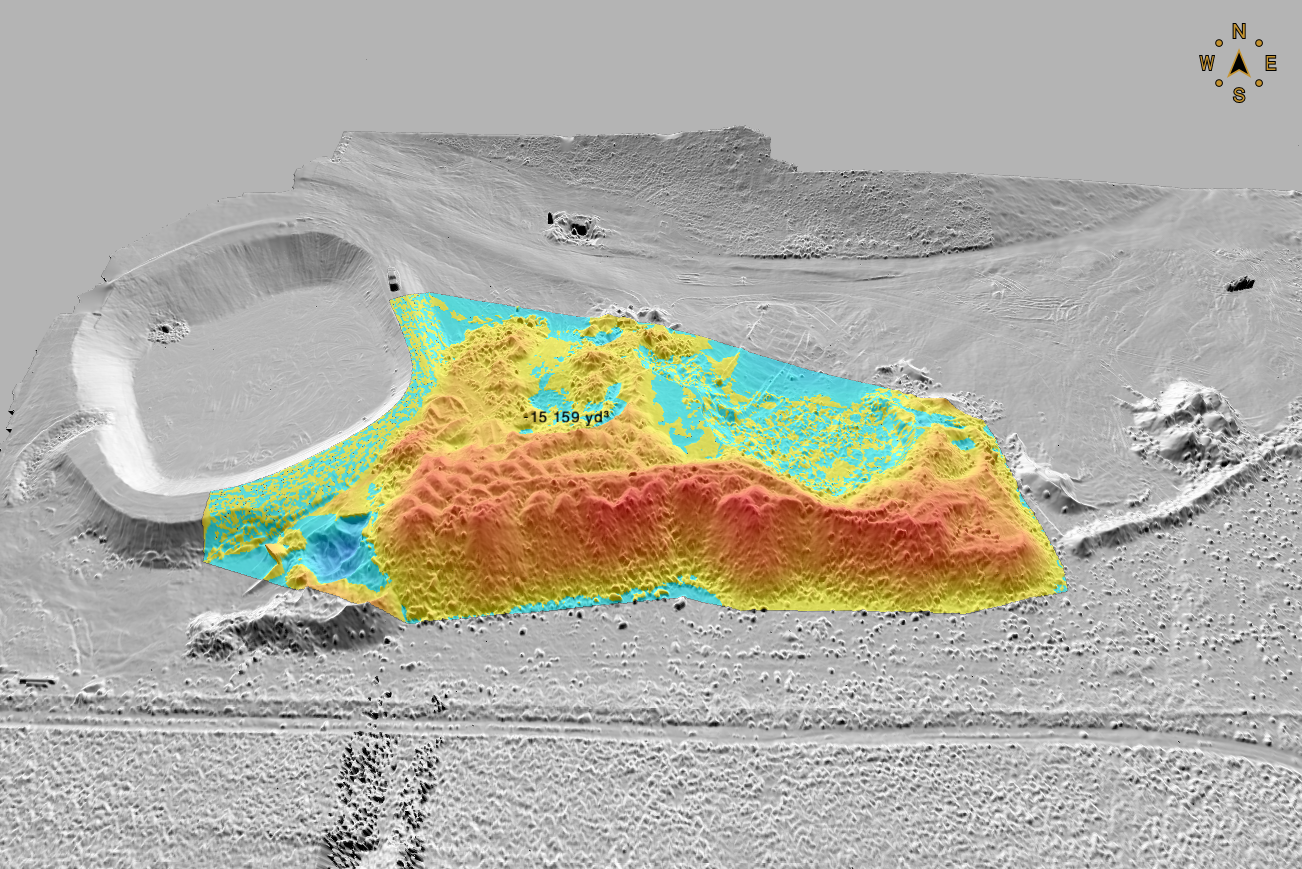
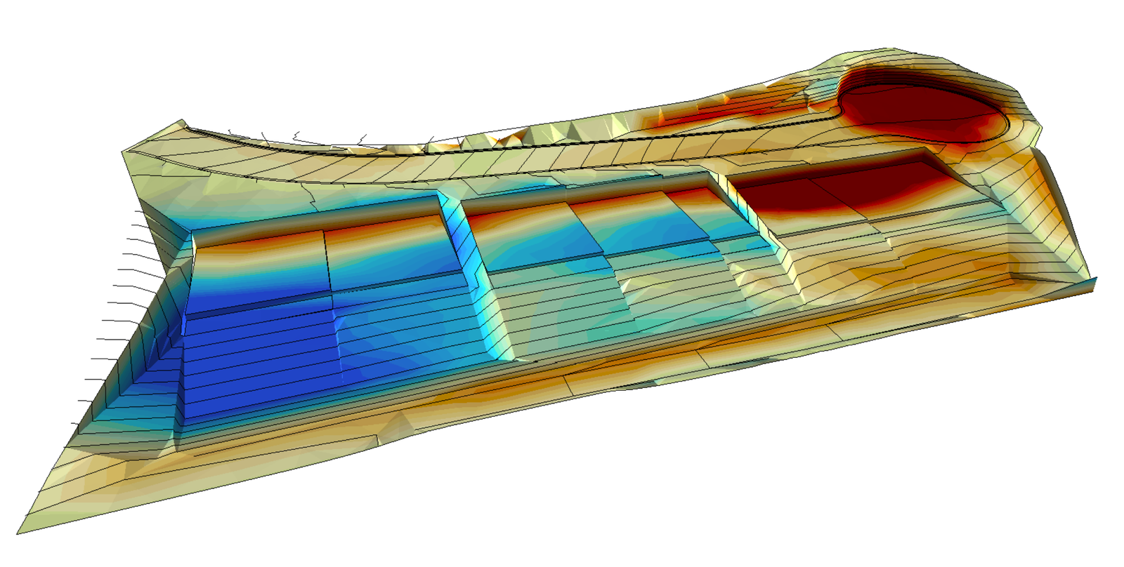
• Cut/fill and dirt volume numbers — know your import/export BEFORE you bid the job
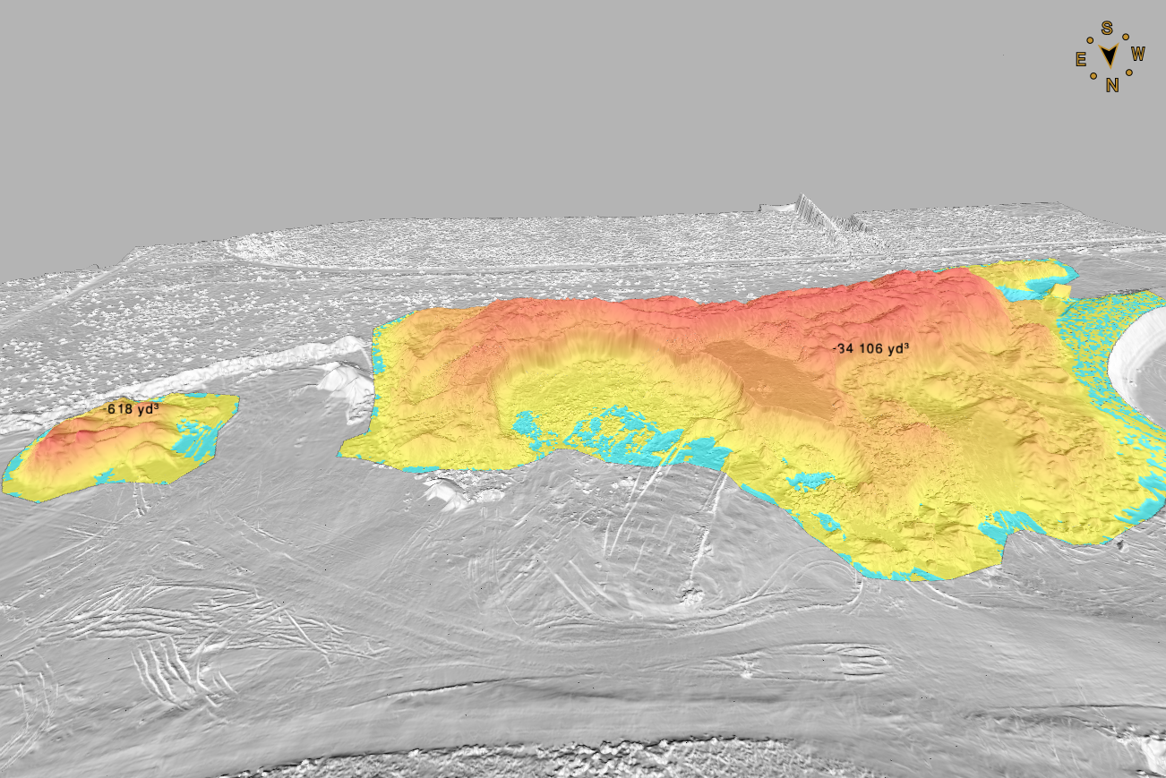
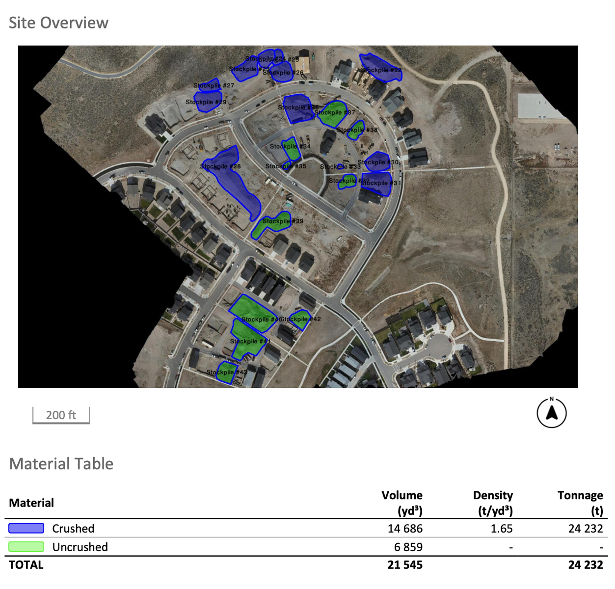
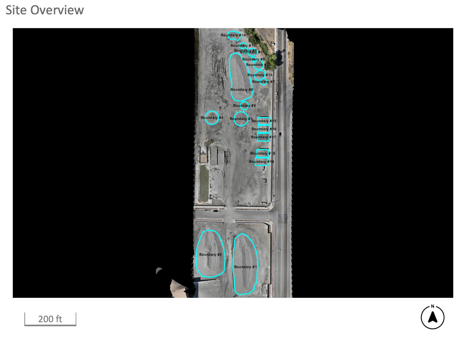
• Stockpile volume reports in yards and tons — month-end inventory without climbing a single pile
• Weekly or monthly construction progress flights with shareable photo maps
• Land and acreage aerials for listings, planning, or just “what do I actually own?”
WHO THIS IS FOR: excavation and site contractors, home builders, developers, gravel pits and landscape
yards, farms, realtors, and landowners who want real numbers instead of guesses.
SIMPLE, HONEST PRICING:
• Small sites (up to 10 acres): $495 flat
• Bigger parcels: per-acre rates that DROP as the acreage goes up — send me the address and I'll have a
firm quote back to you same day
• Stockpile checks: $450/visit (up to 5 piles)
• Monthly progress-flight packages from $350/flight
Licensed and insured.
Local, low overhead, no fluff — you're paying for data, not somebody's
downtown office lease.
Call or text (801)829-1412, or message this page with the property address and what you need.
Quotes back same day — usually within the hour.
I provide aerial mapping data and measurements — not boundary or legal land surveys. If your project
needs surveyor-certified topo for permits or engineering, I team up with licensed Utah land surveyors and
can package the whole job for you.
Provided by ACP Systems
#DroneMapping #UtahConstruction #Excavation #WasatchFront #SaltLakeCity
Drone Mapping & Aerial Site Data
1 Hour
14
0
$1,234.00
Description
Condition
Payment Types Accepted
VenmoNOW BOOKING: Drone Mapping & Aerial Site Data — Wasatch Front
Big survey firms charge big-office prices and put you on a three-week waitlist. I fly your site this week and get your data back in 24–48 hours — usually for less than half of what they'd charge.
WHAT YOU GET:
• High-resolution aerial site maps you can measure right on your screen
• Elevation and contour data for grading, drainage, and site planning
• Cut/fill and dirt volume numbers — know your import/export BEFORE you bid the job
• Stockpile volume reports in yards and tons — month-end inventory without climbing a single pile
• Weekly or monthly construction progress flights with shareable photo maps
• Land and acreage aerials for listings, planning, or just “what do I actually own?”
WHO THIS IS FOR: excavation and site contractors, home builders, developers, gravel pits and landscape
yards, farms, realtors, and landowners who want real numbers instead of guesses.
SIMPLE, HONEST PRICING:
• Small sites (up to 10 acres): $495 flat
• Bigger parcels: per-acre rates that DROP as the acreage goes up — send me the address and I'll have a
firm quote back to you same day
• Stockpile checks: $450/visit (up to 5 piles)
• Monthly progress-flight packages from $350/flight
Licensed and insured.
Local, low overhead, no fluff — you're paying for data, not somebody's
downtown office lease.
Call or text (801)829-1412, or message this page with the property address and what you need.
Quotes back same day — usually within the hour.
I provide aerial mapping data and measurements — not boundary or legal land surveys. If your project
needs surveyor-certified topo for permits or engineering, I team up with licensed Utah land surveyors and
can package the whole job for you.
Provided by ACP Systems
#DroneMapping #UtahConstruction #Excavation #WasatchFront #SaltLakeCity
